Sunday, August 17, 2014

Curry Mountain

Date: 8/17/2014
Distance: 6.6 miles
New Map Miles: 3.3
Total Map Miles: 466.3

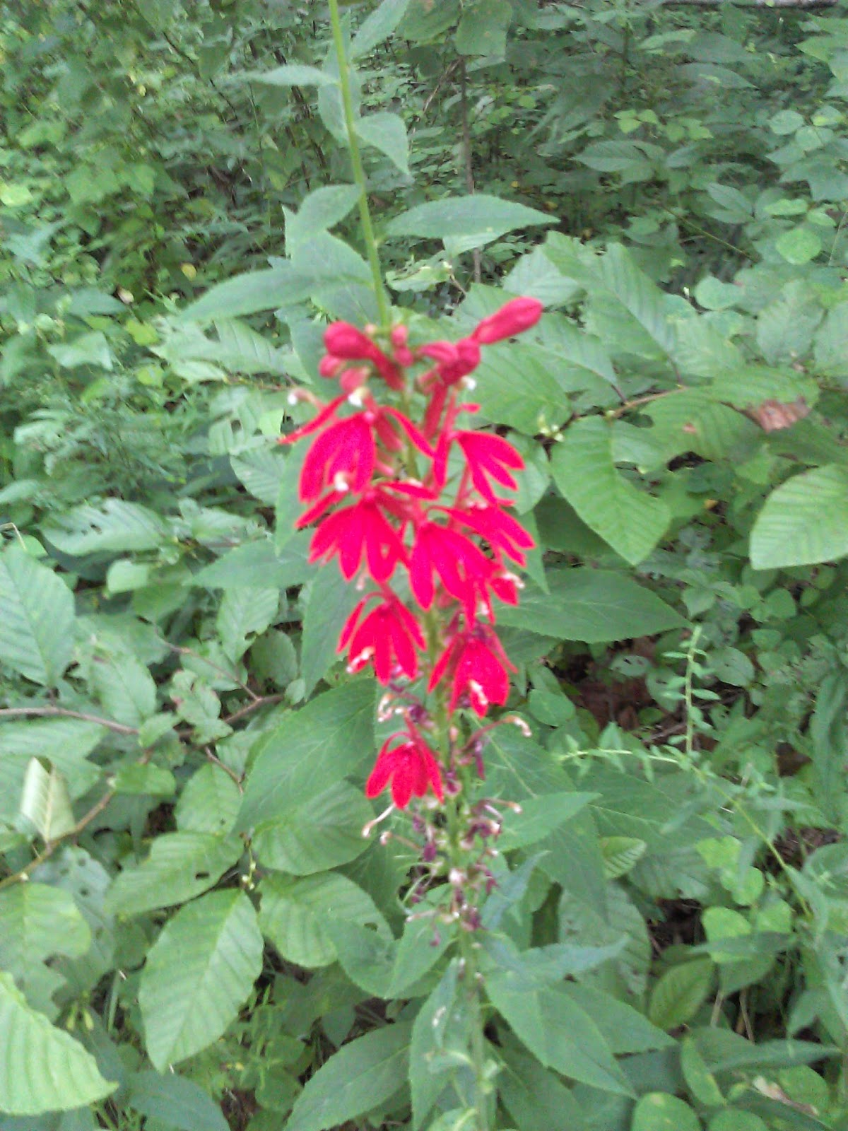
After yesterday's nice hike up Meigs Creek, I went back on Sunday Afternoon to get Meig's neighbor Curry Mountain.  Access to the trail is gained by parking at the Metcalf Bottoms picnic area and walking about 100 yards down the Little River Road towards Sugarlands.  There is no parking directly at the trailhead.  The trail did start with a group of nice red wild flowers.
There was also a blow down that wasn't far down the trail that required a bit of effort to get over.

 The Trail looks to be an old road so it is wide and fairly easy to hike.  It was uphill most of the way.

There was lots of evidence of bears on the trail, but I wasn't lucky enough to spot one.  This trail had been closed earlier in the year for bear activity.

There were a few spots that you could get some scenic views through the trees.
I spotted this nice flower up at near the end of the trail in one of the open spaces where the sun was shining.


At the sign, I turned around and headed home.  It was a nice little workout with about 1000' of elevation gain.  It made for an enjoyable afternoon.

Saturday, August 16, 2014

Meigs Creek

Date: 8/16/14
Distance: 7 Miles
New Map Miles: 3.5
Total Map Miles: 463

On this Saturday, time was limited, so I chose a short hike up Meigs Creek Trail so that I could get back home by 12.

I had heard that Meigs Creek Trail was a Creek Crossing nightmare with 18 or more creek crossing, so I packed the Chacos in my pack and set out expecting to get wet feet.  The trail leaves from the Sinks parking lot on the Little River Road.  The sign wasn't obvious from the parking area and I was a little worried that I had misread the map, but after a short walk to the Sinks overlook, the trail sign was there to greet me.


The trail started as a well maintained trail that headed up and over a 300' ridge.
Up on the top of the ridge, there were a few nice views out through the trees.


Once the top of the ridge was reached, a short hike down the ridge brought me to the 1st creek crossing.  It hadn't rained since Monday, and the water level was low.  There were plenty of rocks to choose from and I easily hop rocked it.
This turned out to be normal for the hike.  All of the crossings were easily hopped.  I counted 18 crossings, but only about 13 were significant.

After about 3 crossings, there was a nice waterfall.

After about 8 crossings, the trail passed an open flat area with this very large tree.  I'd guess that this was the location of an old homestead.
After about 10 crossings, the trail got narrow and overgrown in a few places, but I've seen worse.

The trail was 3.5 miles in length.  At the end, I turned back and retraced my steps.


 The climb peaked out at 2400' having started at 1600'.  The total hiking time was about 2:06.


Saturday, August 9, 2014

Road Prong - Chimney Tops

Date: 8/9/14
Distance: 8.8 miles
New Miles: 4.4
Total Miles: 459.5

The forecast wasn't good today with a threat of heavy rain and thunderstorms.  I opted to knock out the Chimney Tops and Road Prong trails as they were relatively short.

I parked at the Chimney Tops trail and headed down the trail at about 10:15.  The Chimney Tops trail is a favorite of visitors to the Smokies, so it is well used.  It has been undergoing maintenance and is only open on the weekends.  The trail starts by crossing the creek a few times before heading up hill.


As part of the renovation, lots of steps have been put in .

0.9 miles into the hike, I turned left on Road Prong and headed up the mountain.  The Road Prong trail starts out very rocky.  Today with the rain overnight the rocks were slippery in a few places.


The lower section of the trail hugs a creek with some nice cascades.

 Road Prong had some really nice wildflower areas.


At one point, the trail turned into a creek.  I was even a bit worried that I had lost the trail.  All of these photos are actually the trail.


 Up at the Clingmans Dome Road, the trail ends after 2.4 miles.  I was happy to find a nice grove of Blackberries next to the road, so I had a feast before heading back down the trail.


 Back at the Chimney Tops trail, I was greeted by more steps and a steep climb up to the Chimney tops.


I spent a good while up on the rocks eating lunch and enjoying the views.  Unfortunately it started raining while I was up on the rocks and I had to carefully work my way off of the wet rocks.  The rain was light and quit pretty quick, so I didn't need to get my rain jacket out.  I made it down safe and sound and headed back to the car arriving about 2:45.


Saturday, August 2, 2014

Low Gap - AT - Snake Den Ridge

Date: 8/2/2014
Distance: 13.2
New Map Miles: 7.6
Total Map Miles: 455.1 - Switched to new spreadsheet which had slightly different mileage

Today I went to the Cosby side of the park to pick up the Snake Den Ridge Trail.  I had intended to head directly up Snake Den and circle around to return on Low Gap, but I failed to locate the trailhead before ending up on Low Gap.  I just decided to hike clockwise instead of counterclockwise.

The day was overcast with a little drizzle when I started out. Low Gap was as tough as last time with a 3000' climb in only 2.5 miles.  I was pretty sweaty by the time I reached the gap.  There were some nice flowers along the trail.


 Once I reached the AT, I turned right and continued on the AT.  It had a good climb as well for about the 1st mile and then leveled off for a while before dropping down to the Camel Gap Intersection.
The stretch between low Gap and Camel had more wildflowers to enjoy.


 After Camel Gap, there was another good climb up the the Snake Den Intersection.
 The clouds finally started to lift a bit and I got a few views along the AT.


 At Snake Den, the downhill portion started.  It was a bit tough on the knees.


At one point, a doe appeared on the trail.  It would run ahead and I'd eventually catch her and it would run again.  This went on for about .25 miles before she got bored and jumped into the woods.  She is barely visible on the trail in this photo.
Snake Den started pretty rocky at the top.  The 1st 3 miles were also the steepest.  There were also a few overgrown areas, so it wasn't just a walk in the park.  There was one location where the creek had to be rock hopped, but it was easy to traverse.

 Snake Den lived up to its name as I found 1 snake in the trail.  I tried to make it move before I continued on, but it was content.  Eventually, I just jumped over its tail and took off.

 The last mile was on a gravel road.  A Cemetery was beside the road just as the trail met the gravel road.


Down at the bottom, I took the 0.3 mile segment of the campground trail over to Gabes.  I then took Gabes back to the campground (0.3).  I also got just a piece of the trail from the Hikers parking lot back up toward the campground.