Distance: 18
New Map Miles: 7.8
Total Map Miles: 782.4
The last couple weeks East Tennessee has been slammed by winter storms. The kids have been out of school 2 full weeks. The most recent snow came down Wednesday night (3-4" at our house). Today, I was suffering from a great desire to get out in the woods after many days of cold weather. Today the temperatures were forecast to be in the 40's and the skies were blue. The Northern 7.8 miles of Old Settlers was my target. It was a great choice as many park roads were closed, but the Maddron Bald Trailhead isn't on a park road. To get to Old Settlers on the Northern end, it is necessary to hike 1.2 miles up the Maddron Bald Trail. Maddron Bald was snow covered by tracked down a bit by previous hikers.
 The cabin on Maddron Bald was very scenic in the snow.
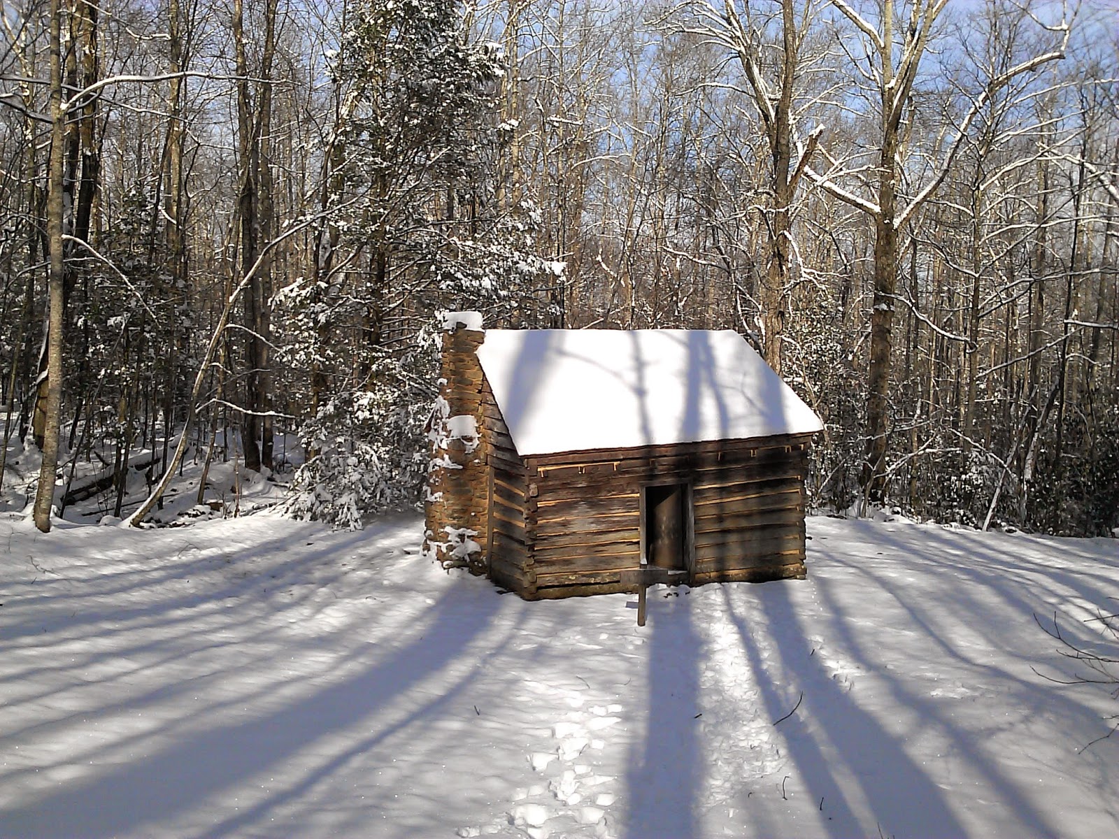
The 1.2 miles went quickly. I was surprised at the Old Settlers sign to see that no one had been on the trail. The snow was 4-6" deep and it wasn't completely obvious where the trail even was. With a rush of "snow adrenaline" I plowed down the trail.

A mile or so down the trail, I came to a footbridge that was snow covered.


 The creek it crossed was full of snow covered boulders.

I hated to leave my footprints on the bridge. It ruined the scenic picture.
 The next crossing did not have a bridge and was a little scary as I had to jump across the water to a snow covered rock at one point. This trail had numerous creek crossings. The 1st one after the bridge was the worst. Most of the others were navigable without too much effort.
The trail continued to be snow covered for about 4.5 miles.
At that point, I arrived at a sign which indicated a Barn (McCarter) was off to the right. I saved the barn for the trip back. At this point the trail had been well traveled. I had assumed that hikers had come from the other direction and turned around at the barn. I found out later that this wasn't accurate.
I followed the footprints for a couple miles, but then a very large tree was laying in the trail and the footprints ended. I wondered around looking for the trail and eventually decided that the tree was a recent blowdown and I was going to need to climb through it. I made my way through the tree, only to find that there were no longer footprints.
This concerned me greatly as I couldn't imagine where the other hiker had gone. I pressed on though as the trail seemed correct. However it steadily got smaller and eventually I was only able to find it because some animal had left prints. At several locations, I saw where trees had been chainsawed out of the trail, so I was pretty sure I was on some sort of semi-maintained trail, but it just didn't seem right. It seemed too steep in spots and a little too overgrown in others. I was concerned that I was following this animal well off the trail. After about 2 or 3 miles of this, I ran into a group of 4 hikers coming the other way and was relieved to find out that I was indeed on the Old Settlers Trail still.
Another mile after passing them, I found my tree from 2 weeks ago. Unfortunately, I walked right by it but a few tenths on down the trail was a very large wall with a chimney behind it. I remembered it from last time, so I turned back and found my wall with the tree coming out and the very large tree behind the wall.


I turned back and backtracked toward the car. I did take the short side trail to the McCarter Barn.


It turns out that there is a road to the barn. It was snow covered and probably closed. I don't know where it comes out. The tracks from earlier in the day, left behind the barn toward 321. There was an obvious trail.
I didn't go check it out as all of my "Snow Adrenaline" had run out. I was getting tired fast. Hiking in the snow requires some extra effort.
This trail had several climbs in this section. I don't think they were particularly high, but the snow made any climbing challenging.
It was a great day in the snow.


.jpg)


.jpg)