Thursday, October 30, 2014

Rough Fork - Caldwell Fork - Hemphill Bald

Date: 10/30/14
Distance: 13.7
New Map Miles: 12
Total Map Miles: 617.4

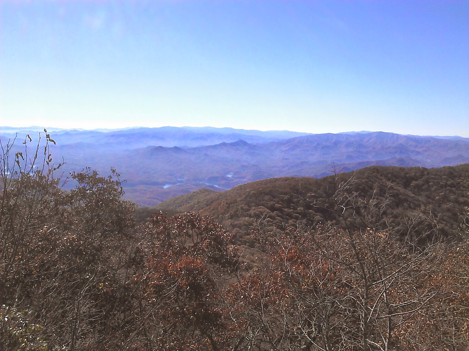
Today was a beautiful clear Thursday and bad weather was forecast for the weekend, so I took a day off to get a few new map miles.  I dropped off Nathan at school at 7:00 and headed for Maggie Valley.  After passing through Maggie Valley, I turned on the Blue Ridge Parkway and then turned right on Heintooga Road.  This road closes on 11/2, so this was the last chance for me to go get today's trails without adding 6 miles to the hike.  After entering the park on Heintooga, I parked at the Hemphill Bald Trailhead parking area at 9:15.

It was cold up high on the mountain where the trail starts, so I was wearing gloves, hat, and two fleeces to start the hike.  This was an excellent loop hike.  I opted to hike it clockwise starting on the Rough Fork Trail.  Rough Fork looks to be an old road, so the trail is pretty wide.  It started with a slight slope down hill for about 2 miles and then it dropped off of the mountain.


 3.5 miles into the hike, Caldwell fork meets Rough Fork.  I turned right onto Caldwell and continued on down the mountain for 1.4 miles to campsite 41 that was right next to a creek with a foot bridge.


After crossing the creek, the trail starts climbing.  Just a few tenths after the campsite, Hemphill Bald intersects Caldwell Fork.  I turned on Hemphill.


 There were at least 2 places where the trail became a creek in the 1st couple miles, but the water was low and it was simple to rock hop.  The trail continued to rise at a steady state until reaching the Cataloochee Divide Intersection.


 At this point, Hemphill turns to the right and hugs the park boundary.  Just across the boundary is the Cataloochee Ranch.  The trail continued its climb.


 Up at the top is a gate through the fence and a few benches that I sat on for lunch.  There was a nice view of the ski area down below.


 From this location, the trail continued through a few more dips and climbs before the easy walk to the car.  Total hike time was about 5 hours.


Tuesday, October 28, 2014

Clingmans Dome - AT - Welch Ridge - High Rocks - Bear Creek - Lakeshore - Lakeshore Bypass

Date: 10/25/14
Distance: 21.7 mi
New Map Miles: 12
Total Map Miles: 605.4

Today's awesome hike was from Clingmans Dome down to the Tunnel to No Where.  The hike was organized by JD with the GSHAG group.  JD arranged a bus to pick us up at the Tunnel and take us back to Clingmans Dome.  The Bus was a school bus from the Cherokee Boy's Club.  We had 44 hikers and the cost was only $6 each.  Multiple hikes were organized from the Clingmans Dome road down to Deep Creek and the Tunnel.  The hike I chose was a 21.7 mile trek down the mountain with a surprising number of climbs along the way.

We started about 7:20 in the dark by taking the Clingmans Dome bypass trail up to the AT.  The sun was just rising as we reached the AT and there were some awesome views along this 3.8 miles along with a few climbs.


After 3.8 miles on the AT, we took a left onto Welch Ridge Trail and followed it all of the way to high rocks.


At High Rocks, we took a right and went the 0.4 miles up to the overlook.  High Rocks appears to be the site of an old lookout tower which has been removed except for the concrete footers and an old chair.


 There are also the remains of an old cabin just beyond the rocks.


From High Rocks, we backtracked to Bear Creek and started our decent to Lakeshore.  Bear Creek has a rather severe drop and was very rocky in places.  The rocks were buried under the falling leaves which gave some exciting moments.

Unfortunately down where there trail had flattened out and was much nicer, JD had a freak accident and nearly stuck his hiking stick in his eye.  He was a real warrior, hiking out holding a bloody rag over his eye for > 6 miles.

Down at Lakeshore, I took the Tunnel Bypass trail to pick up that 1.2 miles.

Awesome day for a hike with great company on the trail (JD, Bill, Ahmad, Jenn, Eddie, Brian, Russ, Dawn, Eve, Keith).  We exited about 4:00.

Bus arrived at 5:00.  It was nearly 7:30 before we got back to Sugarlands as 441 was blocked for an extended time on the way down the mountain.


Friday, October 17, 2014

Low Gap - AT - Mount Cammerer - AT - Lower Mount Cammerer

Date:  10/17/14
Distance: 16.5
New Map Miles: 14.4
Total Map Miles: 593.4

Today the weather was just incredible, so after a few hours at work, I drove over to Cosby to mark off some map miles.

I parked in the Hikers Parking Area and walked up the trail that leaves the parking area to Low Gap. Low Gap as always was a trudge up the mountain, but the weather was cool and I felt good.  At the AT, I turned left.  The elevation continued to rise, but there were some nice views and after a short distance, the trail leveled off and it was a nice high altitude hike over the Mt Cammerer.


At the Mt. Cammerer trail, I took a left and went out to the old fire tower.

The skies were clear and the views were awesome.


After a short visit at the top, I returned back down the Cammerer trail to the AT and took a left.


This 2.3 mile section of the AT had lots of elevation drop.  It was quite steep at times with a number of stairs built into the trail.  After 2.3 mi, I turned left on Lower Mount Cammerer trail for the final 7.4 miles to the car.

About 1.3 miles from the campground, there was a sign indicating an overlook was 200yds off of the trail.  I went up to check out the view and took a few photos.


I followed Lower Mt Cammerer all of the way to the campground and then turned back to get the 1 mile piece on the map that goes down to below the Hikers Parking Area.  The trail was labeled Horse Trail.  It was in pretty good shape.  There were a few creeks that I hop rocked.  At the end of the 1 mile, I came out on the road and walked back up to the car.  It was a great day for a hike.