Sunday, July 27, 2014

Maddron Bald

Date: 7/27/14
Distance: 14.8
New Map Miles: 6.8
Total Map Miles: 446.6

Today I headed over to the Cosby area of the park to hike the Maddron Bald Trail.  The trailhead is located on 321 a few miles from Cosby.  If you get to Jellystone, you just missed it.

The trail starts on a gravel road.  About 0.5 miles up the trail is a nice cabin.


Most of the trail is near a creek that must be crossed multiple times on the hike.


About 3.7 miles up the trail, you reach the Albright Grove Loop.  It is a walk through the woods with some big trees.  Shortly after leaving Albright, the trail started getting narrow and overgrown.  There were some nice flowers.


About 3 miles from Albright Grove, the trail reaches the Bald where there are some nice views.


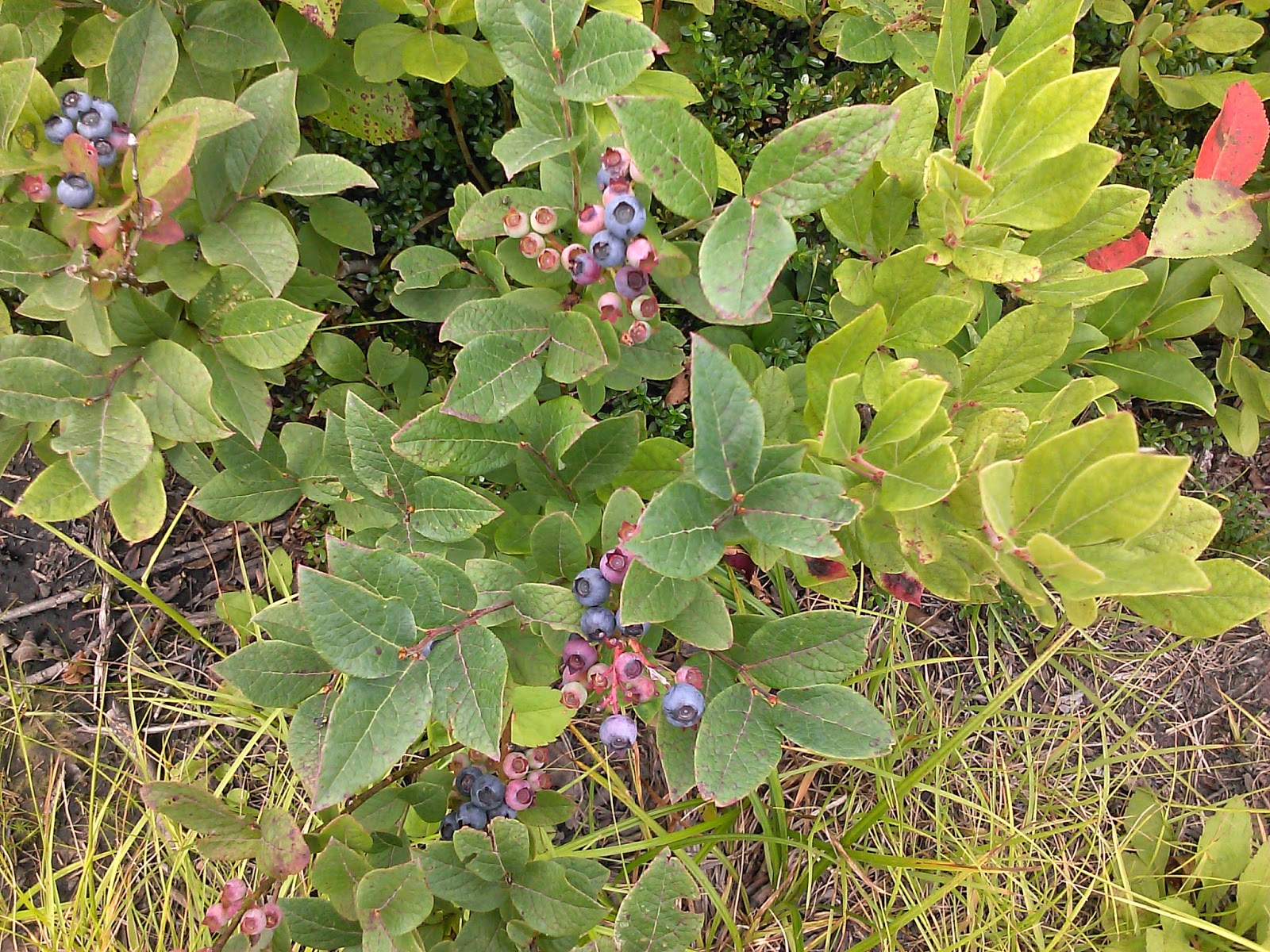
There were also Blueberries which were awesome!


At the Snake Den Ridge Trail, I turned around and headed back down.


Back close to Albright, I found some nice blackberries.  These are just a few of the many I found.


After Albright, there were about 3 semi difficult creek crossings.  The 1st one was the worst one.  The hike did have a significant climb from about 1900' to 5400'.  I left the car at 12:20 and was back at the car at 6:15.

Sunday, July 20, 2014

Backpack - Clingmans Dome to Cades Cove (AT, Bote Mtn, Anthony Creek)

Date: 7/19/14 - 7/20/14
Distance: 21.4
New Map Miles: 8.5
Total Map Miles: 439.8

This weekend I backpacked with the GSHAG group from Clingmans Dome to Cades Cove.  We met at the Y and shuttled cars to the Cades Cove Campground and then shuttled up to Clingman's Dome.  This took about 2 hours.

The day was very rainy and the hike started in a downpour.  The hike up the Clingman's Dome trail was brutal as usual.  Fortunately there are 2 shelters in the 1st 5 miles.  We stopped in each and dried out a bit and regrouped.  The final 5 miles to Derrick Knob was the toughest part of the day with a few good climbs.

At Derrick Knob we arrived to a shelter packed full of people.  A trail maintenance crew was tent camping at the shelter, but due to the weather, they were all hanging out in the shelter.  There were also a few other hikers who packed up and left when we arrived.  The looked pretty disappointed.

The shelter was in good shape.  It didn't have a privy and there were some mice. A few food bags were attacked by a critter while up on the bear pulleys.  We were instructed to open all of the pockets on our packs to avoid damage to our packs in the shelter.

I had the Mountain House spaghetti and enjoyed it.

I tried a NyQuil to help me sleep, but I still didn't sleep much.  It rained or the wind blew water from the trees most of the night.  It was pretty cold, but I was comfortable in my bag.

On Sunday morning, we headed out about 8:20 in the pouring rain.  Thankfully, about 15 minutes in, the rain slacked off and eventually it stopped completely.  The 5 mile hike to Rocky Top was tough with a big climb over Thunderhead.  It took 2.5 hours to get to Rocky Top.  We waited for about 40 minutes and then decided to head on down the mountain and wait at the bottom.  I got to the picnic area at 2:00.

It took till about 4:30 before enough hikers exited to start the shuttle.  Jeff drove us to the Y and I drove Conrad and Warren up to Clingman's.  I left Clingman's at 6:00, getting home about 7:45 after sitting in traffic due to an accident and picking up a pizza.

Even with the foul weather, the hike was enjoyable.  It was a nice challenge to hike over Thunderhead and the views from Rocky Top were nice.


Sunday, July 13, 2014

Cataloochee Divide

Date: 7/13/14
Distance: 12.8 mi
New Map Miles: 6.4
Total Map Miles: 431.3

Today I hiked the Cataloochee Divide trail as an "in and out" hike.

The trail is just along the edge of the park boundary in the Cataloochee area.  There are some locations with nice views of the surrounding mountains.


Most of the trail is along a fence that I assume marks the park boundary.


About 4 miles into the hike is "The SWAG".  I'm not sure what "The SWAG" is, but it looks like a nice place to sit and enjoy the view.


6.4 miles into the hike, I reached the Hemphill Bald trail.  I chose to turn around at this point and return to the car.  It was a nice day in the woods, not too difficult, just right for a Sunday afternoon.


Thursday, July 3, 2014

Forney Ridge - Springhouse Branch - Noland Creek - Noland Divide

Date: 7/3/14
Distance: 18.5
New Map Miles: 12.4
Total Map Miles: 424.9

Today's hike started from the Clingmans Dome parking lot.  There were a few clouds, but the views were still great.


I headed down the Forney Ridge Trail for the 1st 5.6 miles.  On the map, the trail said 4.5 miles, so I was a little surprised to find the extra 1.1 miles.  In a few spots, there were some nice balance beams.


1.8 miles into the trip, I arrived at Andrews Bald.  The azaleas were past their prime, but the view was great.  The trail immediately became less maintained and the hiking was a little difficult.  After a couple of miles, the trail improved and the hiking was nice. 


At 5.6 miles, I took a left on Springhouse Branch trail.  


On Springhouse, I came across a wild hog standing in the trail.  We stared at each other for about 5 seconds before he turned around and went the other way.  I continued on and in a few minutes, I heard him down below me headed back to were we 1st met.

The trail started out pretty good, but shortly after I passed 4 horsemen, it got worse.  The trail was a little torn up and there were several places that the trail turned into a creek.

Near the end of Springhouse, I spotted this rock wall beside the trail.


At the end of Springhouse, the downhill part of the hike was over.  I started at 6300' and at the end of Springhouse the elevation was only 2500'.

Noland Creek as the name implies follows a creek up the mountain.  The 1st few stream crossings had some old looking log bridges.


The creek was a nice companion for the hike.


The trail looked to be an old road.


There were 3 big stream crossings which didn't have bridges.  The 1st one (shown below) required me to deboot.  It was cold even in June.  It was a nice chance to wash off a bit and relax.

The next 2 I managed to hop rock, but it took some effort to find a good spot.

 By the time I reached Noland Divide, the trail had turned into the classic single track trail.


The hike up to the Dome road was a tough climb after a long day.  Once out on the road, it was a 1.3 mile walk to the car.  Back at the car, the views were still spectacular.