Showing posts with label Balsam Mountain. Show all posts

Sunday, March 13, 2016

Laurel Gap Backpack Day 2 - Balsam Mtn - Gunter Fork - Big Creek

Date: 3/12/16
Distance: 21.4 miles

After a night of tossing and turning, we packed up and left the shelter about 7:40.  We hiked the 1.2 miles from the Shelter over to the Gunter Fork Trail and I had a decision to make.  The group plan was to just hike down Gunter Fork to Big Creek for a total of 11.6 miles, but I really wanted to hike the portion of Balsam Mtn from Gunter over to the AT.  This is a hard section to hike because it is 4.9 miles long and is 10 miles from anywhere.  The trail is fairly flat, but if I decided to hike it I was looking at a 21.4 mile day.  I was feeling pretty good that morning and the pack wasn't feeling horribly heavy, so I said so long to my hiking partners and headed for the AT.

Balsam Mountain trail didn't feel quite as flat as the Brown Book would indicate, so the 4.9 mile walk over to the AT was a little more difficult than I expected, but it is a really pretty section of trail.  Most of the trail is in a Fir forest.  Much of the trail is covered with pine needles and is easy to hike, but there are also sections that are very rocky and rooty.

 Sometime you walk by stuff on the trail that just makes you go Huh.

 I made it out to the AT in about 2 hours (from the shelter), took a picture of the sign and quickly turned around for the 4.9 miles back to Gunter Fork.
 Balsam had quite a few trees laying in the trail.
 There were some really nice views through the trees, but they don't show well in photos.


 Back at Gunter Fork (11 miles into the day), I took a short break and ate some lunch before heading down the mountain.  Gunter Fork can be dangerous if it has rained recently, so I was glad that today was only cloudy and not rainy.
 The top of Gunter is often narrow and it feels as if it would be easy to misstep and slide down the side of the mountain.  It was also fairly overgrown even though the leaves weren't out on the plants yet.

There is one area on Gunter where a landslide has wiped out the vegetation.  It is about 50' across.

Gunter has a few nice views on the way down the mountain.


 The creek crossings weren't unreasonable on this day.  I was able to rock hop each of them.  There were about 7 crossings in all.  The last couple are the largest as you would expect.
 There is a really nice cascade about 1/2 way down the trail.

This is another of the creek crossings.
 When the trail isn't crossing the creek, it is right along the side of it.
 This is the final crossing.

 About 4 miles and after a drop of 2200', I was very happy to see the sign indicating that I had reached the Camel Gap Trail.
 I turned right on Camel Gap which changes to Big Creek after 0.6 miles.  From here it was a 5.7 mile walk down the old road which is Big Creek to the car.

I had done a good job of keeping up my pace on this long day and was just 5 minutes short of a 3 mph pace.  I was "smelling the barn", so I picked up the pace and headed down the trail.

I did stop for a couple more photos and I enjoyed chatting with all of the day hikers that I passed by  on the trail.


I made it to the car by 2:35 for a total hiking time of 6:55.  I was feeling really good on this day and was very happy that I made the decision to hike the extra mileage.  I'm sure the lack of significant climbing helped the pace.

Saturday, March 12, 2016

Laurel Gap Backpack Day 1 (Big Creek - Swallow Fork - Mt Sterling Ridge - Balsam Mtn)

Date: 3/11/16
Distance: 16.7

 Spring weather has settled on East Tennessee and spring fever was raging, so I decided to take Friday off and go to Laurel Gap on a backpacking trip with Bill and Dave.  We made our way to Laurel Gap via the Big Creek, Swallowfork and Mt Sterling Ridge trails.

Big Creek is an old road, so the trail is wide and rather easy to hike.  The trail gains about 1200' over 5.1 miles before it reaches the Swallowfork trail.  Two miles from the parking area is the very scenic Mouse Creek Falls.

 We turned left onto the Swallowfork trail and it started climbing steeply up the mountain.  Swallowfork gains about 2200' over 4 miles.  It was extra tough with the heavy pack.  There were a few views through the trees, but other than that, the trail is just a walk in the woods.
 Swallowfork terminates at the Mt Sterling Ridge Trail.  We turned right heading for Balsam Mountain.  The Ridge trail is very pleasant to hike.  It has a couple small climbs and a long rather flat section.  After 3.9 miles we arrived at the Balsam Mtn trail where we turned left and walked the 0.3 miles to the Laurel Gap Shelter.

 After dumping my pack, I set off alone to hike Balsam Mtn another 1.7 miles down to the Beech Gap trail.  Where I took a picture of the sign and then returned to the shelter.


 The shelter was really nice.  It had a large porch area and a fire ring.  We shared the shelter with a couple of college kids on spring break and a fair number of mice.  Both the kids and the mice were well behaved.


Tuesday, July 21, 2015

Balsam Mountain Road Biathlon 2.0 - Flat Creek – Spruce Mtn – BeechGap II – Balsam Mtn – Hyatt Ridge – BeechGap 1

Date: 7/19/15
Distance: 17.7 (Hiking) 10.0 (Biking)

Back on August 24th of 2014, I spent an entire day marking of pieces of the map around Balsam Mountain Road.  On this day, I repeated the exercise with even more bits and pieces for the 2nd map.

Balsam Road is a rather long (28 mile) gravel road that connects Balsam Mountain Campground to Cherokee.  The road is closed during the winter months and a few years ago it was closed the entire season due to budgetary reasons.  It is a major task to get the trails which leave from that road, so on this day I bit the bullet and went for it.  Nathan needed to be dropped off at Church at 5:30 am for Sonburn, so it was the perfect morning to get an early start.

I drove to the Balsam Mt Picnic area to begin the adventure.  I knew I was in for an interesting day when I had to wait for 2 elk to get out of the road a few miles from the destination.  There was also a mama and baby bear in the road and a whole flock of turkeys.  I only got the camera up in time to get the elk.
 I arrived at the Balsam Mt Picnic area about 7:50 and suited up for a bike ride back down the mountain.  It was pretty cool up high, so I put on my long pants and a thin fleece for the bike ride.  It was about 3.5 miles back down the mountain to the Flat Creek Trailhead.  I locked my bike to a tree, removed the fleece and started down the trail.

Flat Creek starts with a short drop down to the creek and then up and over a ridge before a rather steady climb back up to the picnic area.  Much of the early part of the trail is near the creek.  And in the wet places there were lots of wildflowers.


 Right at the end of the trail, near the picnic area was a nice viewing spot.


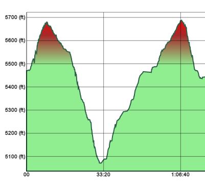
 The elevation graph includes the bike ride and about 8 minutes of preparing to ride at the beginning. The trail had about 600' of climbing over 2.6 miles.  The trail was really nice.  There were a few small stream crossings.
I was back at the car a bit after 9:00.  I drove back down to my bike and picked it up before turning around and heading back up the mountain to Balsam Road.  The gravel road was rough and bumpy which severely limited speed. There were some nice flowers along the road.
 

 I bumped along to the Spruce Mtn Trail arriving about 10:00.  Spruce Mtn is a 1.1 mile trail which ends at a campsite.  Last time I hiked it, it was a little overgrown, so I left my long pants on for the short walk up the  mountain.  I was happy to find that it had been trimmed back and was very pleasant.  This Carolina Lilies (I think) were along the trail.


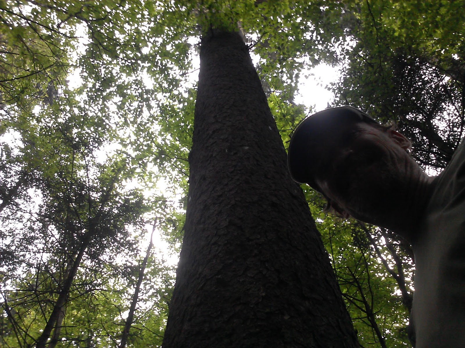
I also enjoyed this huge tree near the campground.


 At the campground, I turned around and returned to the car arriving about 10:45.  This trail climbed about 700' in its 1.1 miles (one way).
I then drove to the Balsam Mountain trail and once again mounted my bike and headed down the road to the Beech Gap Trail.  This was about a 5 mile bike ride with lots of elevation drop (1500' or so).  It was a little scary bouncing around on the bike and keeping the brakes on hard for so long.  At 11:40, I once again locked the bike to a tree and started climbing.  Beech Gap is a tough climb up the mountain gaining 2200' in 2.5 miles. 


 After 2.5 miles, I reached the Balsam Mtn trail where I turned right toward the car.
 Balsam had lots of flowers and was rather pleasant for much of the 2.3 miles back to the car.  It was a little overgrown in a few spots.


 Balsam drops about 700' back to the road.  Total mileage on this section was 4.8 miles.  I was back at the car about 1:15.
The drive down to my bike wasn't much more fun in the car than on the bike.  Once I nearly got stuck in the ditch trying to avoid a big pothole, but eventually I got there (about 1:45),  parked the car and started biking the 1.5 miles down to the Hyatt Ridge Trail.

Hyatt is a near repeat of the big climb up Beech Gap, so it was mentally tough this late in the day to once again start a 2000' climb up the mountain.  The climb is mostly in the 1st 2.5 miles.  Once you get up high, the trail is a pretty nice walk out to campsite 44.  At the campsite, I backtracked 0.9 miles to the other end of Beech Gap I.  I was anxious to get on home by the time I reached this intersection, so I headed down the mountain with some urgency arriving back at the car at about 4:45.


 I returned home via 441 through Pigeon Forge.  I made it to Altruda's to pick up carry out about 7:20.  A big spaghetti dinner was pretty nice after the long day in the woods.