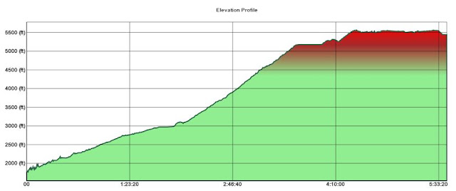
Date: 3/11/16
Distance: 16.7
Spring weather has settled on East Tennessee and spring fever was raging, so I decided to take Friday off and go to Laurel Gap on a backpacking trip with Bill and Dave. We made our way to Laurel Gap via the Big Creek, Swallowfork and Mt Sterling Ridge trails.
Big Creek is an old road, so the trail is wide and rather easy to hike. The trail gains about 1200' over 5.1 miles before it reaches the Swallowfork trail. Two miles from the parking area is the very scenic Mouse Creek Falls.
We turned left onto the Swallowfork trail and it started climbing steeply up the mountain. Swallowfork gains about 2200' over 4 miles. It was extra tough with the heavy pack. There were a few views through the trees, but other than that, the trail is just a walk in the woods.
Swallowfork terminates at the Mt Sterling Ridge Trail. We turned right heading for Balsam Mountain. The Ridge trail is very pleasant to hike. It has a couple small climbs and a long rather flat section. After 3.9 miles we arrived at the Balsam Mtn trail where we turned left and walked the 0.3 miles to the Laurel Gap Shelter.
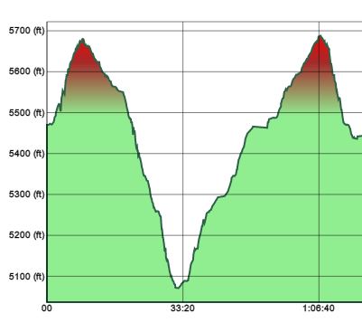
After dumping my pack, I set off alone to hike Balsam Mtn another 1.7 miles down to the Beech Gap trail. Where I took a picture of the sign and then returned to the shelter.
The shelter was really nice. It had a large porch area and a fire ring. We shared the shelter with a couple of college kids on spring break and a fair number of mice. Both the kids and the mice were well behaved.


 After dumping my pack, I set off alone to hike Balsam Mtn another 1.7 miles down to the Beech Gap trail. Where I took a picture of the sign and then returned to the shelter.

No comments:
Post a Comment