Friday, May 16, 2014

Big Fork Ridge - Caldwell Fork - Rough Fork Loop

Date: 5/16/14
Distance: 9.4 mi
New Map Miles: 9.4
Total Map Miles: 374.3

Today I worked till a bit after 10:00 and then headed for Cataloochee.  The drive was about 2:30, but that included a stop at Walmart which had a Subway.  Rain was in the area, but the drive over was mostly dry.  As soon as I got to the end of the road in Cataloochee, it started raining.  By the time I changed clothes and was ready to go, the rain had stopped, so I headed up the Big Fork Trail.
Just 10 minutes down the trail the rain started again.  It even sleeted for a while, so I didn't get the camera out much during the 1st 1/2 of the hike.  Big Fork starts out on a road, but pretty quickly turns into a single track trail.  The 1st 1.7 miles has a climb of about 750'.  After the climb, the trail immediately loses most of the elevation that was gained.  There were a few nice views through the trees.  There were also several creek crossings with bridges.


After 3.2 miles the trail dead ends into Caldwell Fork Trail.  There was a nice rock monument at the intersection.  I took a right on Caldwell Fork and stayed on it for 3.3 miles.


 At one point, a sign said "big poplars" to the right, so I checked it out.  There was only 1 big poplar, but it was big.  There was also a side trail to a small cemetery when I 1st got on Caldwell Fork.

 Caldwell Fork had a climb of about 1000'.  The 1st half of the trail was less steep than the 2nd.  At about 4000' the trail intersected Rough Fork Trail.  Rough Fork was down hill for 2.9 miles to the car.  The slope was pretty severe at times and the trail was very wet at this point even though the sun was now out.  After a couple miles, an old house was beside the trail.

 Back at the car, Cataloochee Valley was looking beautiful.
 Hiking time was about 3:15.

Friday, May 9, 2014

Middle Prong - Greenbrier Ridge - AT - Miry Ridge - Lynn Camp Prong - Middle Prong

Date: 5/9/14
Distance: 21.2 miles

The weather forecast for the weekend wasn't great, so I took a Friday off of work and went hiking.  The hike started at the end of the road in Tremont on the Middle Prong Trail.  I hiked this trail previously in October 2013.  Middle Prong is littered with old artifacts and ends with a nice waterfall. The trail is 4.1 miles long and gains about 1300'.  The climb is steady, but not overly difficult.


Not far after the falls, the Greenbrier Ridge trail heads off to the right.  The trail is 4.2 miles up to the AT with a climb of 1900'.  I had read that there was at least 1 stream crossing the might require de-booting, but the creek was low and I was able to easily rock hop it.
There were still some wildflowers about up at the higher elevations


There were some scenic vistas, but you had to look through the trees.


 At the AT, I made the decision to not turn back, but to turn left on the AT and go down to Miry Ridge for the trip down.


 Surprisingly, I ran into some friends from Church at the AT - Miry intersection.  After a quick lunch, I hiked with them for a mile or 2 before picking up speed to get out of the mountains as rain was scheduled to arrive in the afternoon.

At Lynn Camp Prong, I turned left on Lynn Camp and went back to Middle Prong for the hike out.

 I think this was probably the longest hike I've taken.  The Climb wasn't too shabby either.  I left the car about 8:20 and was back at the car at 3:30, almost 3 mph including breaks.  On the drive out of Tremont, the rain started, so I was glad I hustled on the trail.

Sunday, April 27, 2014

Lakeshore Trail Backpack

Date:  4/25/14 - 4/27/14
Distance: 35mi

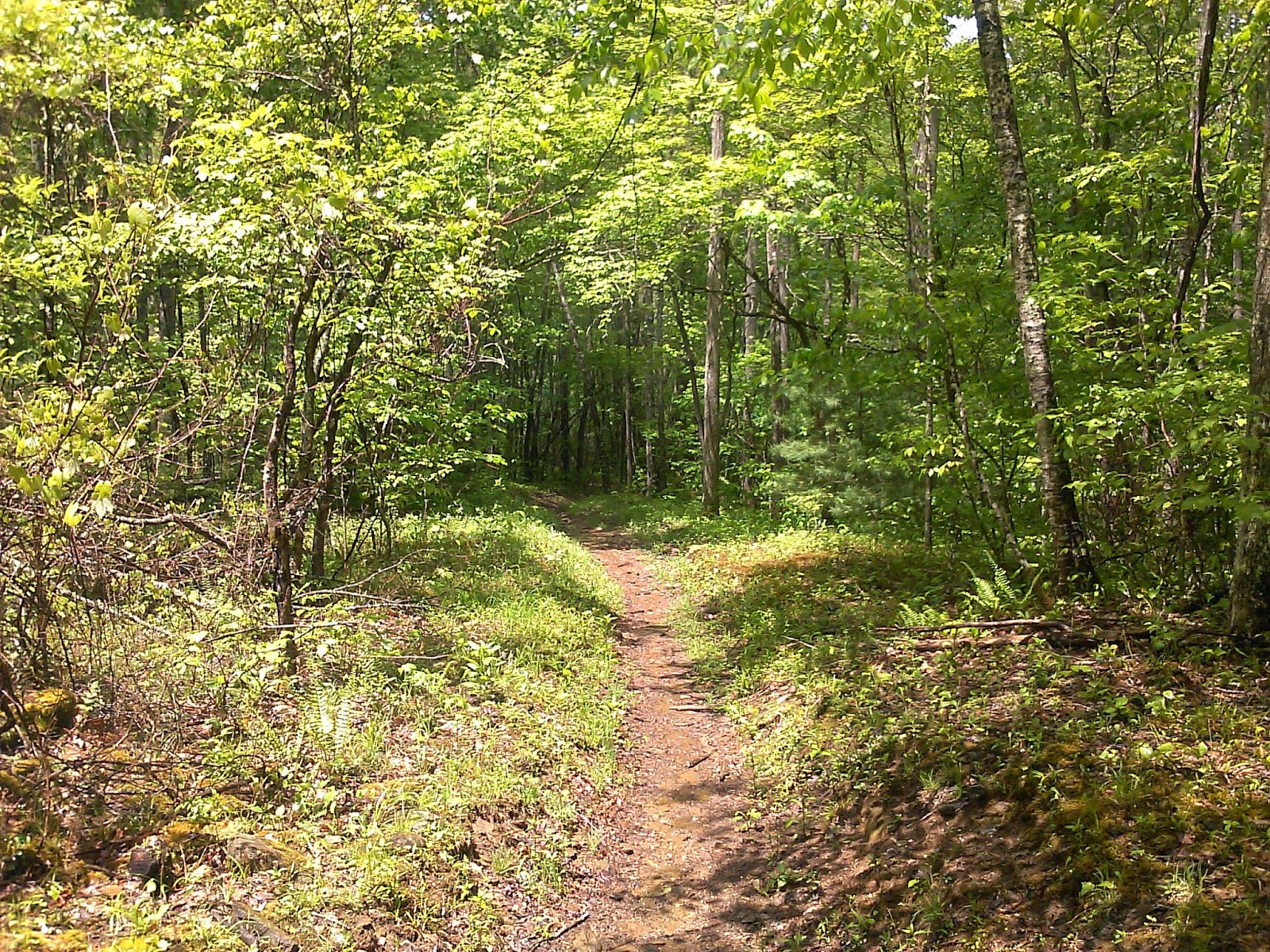
On this weekend, I hiked with the GSHAG group for 35 miles on the Lakeshore Trail.  This was the 1st backpack trip that I had been on since my youth, so I was excited to see how I'd do.  On the 1st day, we drove to Fontana Dam and left a car at the Lakeshore Trailhead.  We then took a shuttle to the tunnel to nowhere.  The drive seemed to never end, but finally we were on the trail after 3 hours of driving.

The 1st day was about 10 miles to campsite 98.  The hike wasn't overly difficult, but the heavy pack took some time to get used to.  The campsite was awesome. It was situated right next to a mountain stream which provided background music to the camp.  It was just a short walk down to the lake with breath taking views and lots of driftwood for a nice campfire.

I had the Mountain house Chicken and Rice for dinner.  It was pretty good on a tortilla.  It was more than I could eat.  Sleep didn't work out so well.  I just couldn't get to sleep.

The next day was tough.  I got up with a pretty bad headache that left me feeling queasy. I had a hard time eating any breakfast, but did drink a fair amount of Gatorade.  Once on the trail, I started feeling better.  I think the hiking helped the most, but I also took a few Advil throughout the day.

We hiked from campsite 98 to 86.  This was a nearly 16 mile day.  The day was very hot and some of the hikers had problems with overheating and blisters.  This slowed the pace and we didn't pull into camp until nearly 6:30.  We also got Ollie Cove when we went by.  This little bit of trail was cruel as it was straight down to the lake and then straight back up.  The tough part of the hike was Welch Ridge which was a big climb late in the day.  By then I was feeling much better, so the climb didn't seem too bad to me.  There were a few nice flaming azalea bushes along the trail and some nice views of the lake.

At the campsite, I had the Mountain House Spaghetti for dinner and I enjoyed it.  I couldn't finish it either.  After a quick cold bath in the creek, several of us walked down to the end of the trail where the Boat Ferries pick up.  This 0.5 miles is on the map, so we picked it up.  It was pitch black and the trail seemed to be covered with frogs.  After a nice time by the campfire, I slept a bit better the 2nd night.  Still not great, but better than Friday night.

I awoke on Sunday feeling good having a breakfast of instant oatmeal.  The hike on this day was about 10 miles with a couple of climbs.  It was another hot day, but knowing the end was near, we all moved at a good pace.  We started about 9:00 and everyone was out before 1:30 with a 20 minute stop for lunch.

Very enjoyable weekend.

Hyatt Ridge - Enloe Creek - Hughes Ridge - Chasteen Creek - Bradley Fork

Date: 4/18/14
Distance:  11.1

Today Gabe and I did a shuttle hike from Straight Fork Rd and Smokemont campground.  Gabe needed Enloe Creek and the entire trail was new miles for me.  The drive over was brutal as it was nearly 3 hours from the front door to the trail.  The hike started with a 1500' climb up Hyatt Ridge.  After loosing 900' the uphill climb continued to a final height of 4500 feet.  After a rest at the top, we lost 2700 feet going down to the campground.  Chasteen Creek Trail was very rock on the trip down, so it was a chore.  The trails had plenty of wildflowers on this day.