Distance: 18 miles
Today I shuttle hiked with Russ and Darrell. We met at Sugarlands Visitor Center at 8:30. We left one car there and piled into another for the drive to the Grapeyard Ridge Trailhead in the Greenbrier section of the park. We started hiking about 9:00.
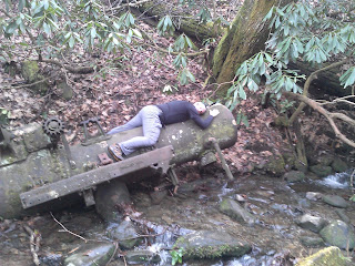
Grapeyard is 7.6 miles in length. It is a very nice trail with very few rocks and roots. It does have a few small stream crossings that I apparently struggled with the last time I hiked it, but today I don't know why. We hopped them all easily. The most famous feature of Grapeyard is the steam engine in the creek. We spent some time checking it out.
Grapeyard has several ups and downs. It does climb a fair amount (about 2600'). The trail ends on the Roaring Fork Motor Trail. There are several historic structures where the trail ends.
We crossed the road and ate a little lunch before continuing the hike on Baskins Creek Trail. Just a few yards down the trail is a Cemetery.
About 1.5 miles down the trail is a sign that points toward the falls. It is about 0.2 miles down the mountain. It is a little steep and muddy down to the base of the falls.
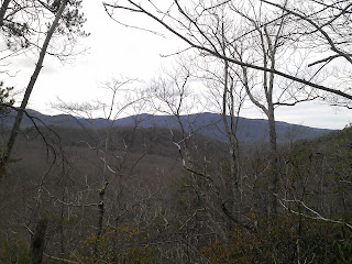
After a few minutes at the falls, we hiked back up to the Baskins Creek Trail and continued toward Trillium Gap. There were a couple of spots in this section with a few views. It was a pretty good climb up Baskins to Trillium Gap Trail (about 800'). Baskins crosses the road and then dead ends into Trillium Gap Trail. We turned right and walked 0.6 mile on Trillium to the Old Sugarlands Trail.
Old Sugarlands covers 3.9 miles back to 441 near the Sugarlands Visitor Center. About 2.5 miles down the trail is the manway over to the Stone House. Since we had some time, I took the guys over to see it. I was thinking it was about 0.5 miles to the house, but it was actually about 1.2 miles with a climb of about 500'.
We returned back the way we came to Old Sugarlands and hiked the final 1.4 miles to 441. We were wishing that we had moved the car closer to the trail as the walk over to the visitor center felt a little long late in the day.
For a low elevation hike, we climbed a surprising amount, but it was nice to cover a long distance with some good friends.


No comments:
Post a Comment