Tuesday, December 22, 2015

Cooper Road - Hatcher Mtn - Abrams Falls - Wet Bottoms

Date: 12/22/15
Distance: 13.9

Today's hike was a really nice loop hike in the Cades Cove area of the park.  I started the hike at the Cooper Road Trailhead which is on the Loop road about 1 mile before the Abrams Falls Trailhead area.  There are only a couple of parking places at the trail, but the hike works equally well starting at Abrams Falls Trail.

Cooper Road Trail is an old road, but the hiking along it wasn't too bad.  It was mostly a dirt track with very few rocks.  The road meanders along the edge of the valley going up and over several small ridges.  At times the road passed through areas damaged by the Tornadoes a few years ago, so if the sun had been out it would have been quite warm.  Today was very cloudy, but the temperatures were in the 60's so I still warmed up and was down to shorts after a few miles.  After 5.7 miles on Cooper Road, I arrived at the Hatcher mountain trail.


I turned left onto Hatcher.  Hatcher was a really nice trail.  It is the classic single track trail and had long stretches without much elevation change.  It also passed through damaged areas.  There were also a few views of the surrounding ridges.


 After about 2 miles, Abrams Creek made its appearance and was a companion for the next 0.8 miles of Hatcher and all of Abrams Falls Trail.


 I turned left on Abrams Falls trail and hiked the 1.9 miles to the falls.


 After a few minutes at the falls, I hiked the 2.3 miles back to the Abrams Falls parking area.  At that point, I turned left on the Wet Bottoms trail.  Wet Bottoms lived up to its name.  Just a tenth or so down the trail, there was a creek crossing.  I could have walked back to the Abrams bridge and just walked along the other side of the creek, but there was a convenient tree that I was able to walk across.  Wet Bottoms is also muddy and mushy and generally not that nice. Wet Bottoms was 1 mile in length back to the Cooper Road trail where I turned right and walked the 0.2 miles to the car.


 This nearly tame dear was on the Wet Bottoms Trail.

 This is the view from the parking area.

The GPS didn't lock for the first 1.5 miles.  The elevation change wasn't huge on this trail, but there were a large number of smaller climbs.

Monday, December 21, 2015

Chestnut Branch - AT from Lower Mt Cammerer to Davenport Gap

Date: 12/20/15
Distance: 7.5

Today I did some Christmas shopping, but by 11:30, I was ready to go hiking.  I arrived at the Big Creek Ranger station about 12:45, and headed up Chestnut Branch.  The trail was in really great shape as it climbed up the mountain beside the creek.  It gains about 1300' on the way to the AT.  There were a few views through the trees on the way.

After 2.1 miles, I arrived at the AT where I turned left hiking toward Mt Cammerer.


 The mile up to the Lower Mt Cammerer trail climbed a bit more (maybe 500').  It had some classic AT hiking along the ridge where you could catch a few views through the trees.
At the Lower Mt Cammerer trail, I turned around and followed the AT out of the park.  The Davenport Gap shelter is well hidden in this photo as the roof was covered with leaves.


After 2.8 miles on the AT the trail hits the Mt Sterling Road. The last time I did this short section of trail, I used my bike to shuttle between Davenport Gap and the ranger station, but today the forecast was for rain, so I decided to just walk it.  It was about 1.7 miles down the gravel road.

This hike didn't have any spectacular sites, but it was a nice walk in the woods and the rain held off to make it better.  This hike pushed me over 500 miles on my 2nd map.

Saturday, December 19, 2015

Eagle Creek - Bote Mtn - Lead Cove

Date: 12/19/15
Distance: 14.1

On the drive home from Mt Sterling last night, I got a text telling me about a chance to hike Eagle Creek today.  Eagle Creek is very difficult to get due to the transportation requirements and the large number of creek crossings.  Winter isn't a great time to hike it, but I wasn't about to pass up the chance.

We met at 6:30AM at the Lead Cove trail where we left a car and then drove over the the Foothills parkway.  Frank (JD's friend) was nice enough to drive us from there to Fontana marina where we boarded the boat about 8:45.  Unfortunately the boat driver was confused and took us to Ollies Cove instead of Eagle Creek.  We were freezing so we weren't paying much attention either.  The temperatures were below freezing and the boat wasn't enclosed in any way.  The driver reversed directions and delivered us to Eagle about 9:45.  It was nice to get off of the boat.

We hike 0.5 miles down Lakeshore to the Eagle Creek Trail where we turned left.  Eagle climbs all of the way to the AT in 8.7 miles.  It also crosses the creek about 20 times and only one crossing has a bridge.  The 1st crossing arrived much too quickly and we geared up for the day.  I opted to wear an old pair of running shoes along with my wool socks.  I think this actually worked pretty well.  My feet didn't get near as beat up as when I didn't wear the socks, and my feet didn't really feel any colder.  The water was COLD though.  Each time I came out of the creek, my feet just ached and I walked funny for a few hundred feet.  After about 18 crossings we arrived at campsite 97 were we crossed one last time and then we switched out of our water shoes as the climbing section was about to begin.

The climb over the last 2 miles was tough.  It is one of the steepest sections of trail in the park.  Eagle gained a total of 3200'.  We finally arrived at Spence field about 3:00.  After a short break, we headed the short distance down the AT to reach the Bote Mtn Trail.  We hike 2.9 on Bote and then the final 1.8 on Lead Cove.  Bote and Lead Cove are steep trails down the mountain, but by now we were ready to be done, so we moved fast arriving at the car about 5:00.

Long tough day, but it is nice to get Eagle marked off on map 2.  With all of the creek crossings, I didn't get the phone out of the backpack and I failed to turn off the GPS when I got in the car, so no pics or gps tracks this time.  See Eagle for some pictures and GPS data from a previous hike.

Friday, December 18, 2015

Mt. Sterling - Long Bunk - Little Cataloochee - Pretty Hollow - Mt Sterling Ridge

Date: 12/18/15
Distance: 19.5

Today I covered nearly 20 miles in the Cataloochee section of the park.  I started the day at Mt Sterling Gap hitting the trail about 8:30.  On the drive up the gravel road, I entered the clouds, so it was very foggy when I started the hike.


The 1st 0.5 miles passed quickly even with a small climb.  At the Long Bunk trail, I turned left and headed down the mountain.  The Long Bunk Trail follows a creek for much of its way down the mountain.  Surprisingly there were a couple of short uphill sections on the way down.  Near the bottom, you arrive at the Hannah Cemetery.


 After 3.7 miles on Long Bunk, the trail terminates at the Little Cataloochee trail which is a gravel road.  I turned left to hike the 1 mile section back over to the road.

 The 1 mile drops down to the creek and then back up to the road where the trail ends.  I turned around and headed for Pretty Hollow which was 5.2 miles away.


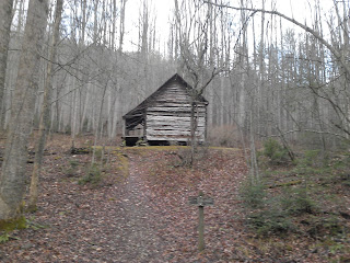
 About 0.3 miles past where Long Bunk hits Little Cataloochee, sits the Hannah Cabin.  It is pretty small but very picturesque.


 About 1 mile from Long Bunk is the Little Cataloochee Baptist Church.  I really like this little church, mainly because it has a bell that you can ring.


After ringing the bell, I headed on down the trail.

 About 1.6 miles from Long Bunk is the Cook Cabin.


 From this point, the trail turns into a single track path and it starts climbing about 1000' in all.  There are numerous rock walls in this section.
 The trail looses all of the 1000' that was gained before it reaches Pretty Hollow.  I turned right on Pretty Hollow and walked 0.8 miles up to the Palmer Creek Intersection where I had some lunch and a bit of a rest.  After lunch, I continued on the 4 mile section up to Mt Sterling Ridge Trail.  Pretty Hollow is a big climb up the mountain in a very pretty hollow.  It follows the creek all of the way up the mountain.  The 1st several crossings of the creek had bridges, but eventually the bridges run out and rock hopping is required.

 At Mount Sterling Ridge, I found the area was covered with ice frozen on the plants, very beautiful.


 I turned right on Mt Sterling Ridge and hiked toward the Tower.  This section of the trail mostly hugs the ridge of the mountain.  It also had a few more climbs and it was cold.  At the Mt Sterling Trail intersection (1.4 miles from Pretty Hollow), I had a decision to make about hiking the 0.5 miles out to the tower.  I decided I was so close that I should suck it up and hike the 0.5 miles over to the tower.  Unfortunately the clouds had moved back in, so the views weren't great.


 About the time that I got off of the tower, I noticed that the spitting snow had picked up.  As I headed down Mt Sterling for the final 2.8 miles to the car, it steadily got heavier until the leaves on the ground were covered.  I also walked through several areas where the trees were covered with ice crystals.