Sunday, May 17, 2015

Rich Mountain Loop - Crooked Arm Ridge - Indian Grave Gap

Date: 5/17/15
Distance: 8.7

Today at about 1:50, I decided that I wanted to hike.  A quick change of clothes and I was in the car headed for Cades Cove.  I parked at the last spot in the lot before the start of the loop road and hit the Rich Mountain Loop Trail about 3:10.

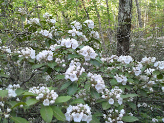
I followed Rich Mountain Loop for 0.5 miles before turning right on Crooked Arm Ridge.  The trail follows a small creek for a short distance, but pretty quickly leaves the valley and heads steeply up the mountain with a number of switchbacks along the way.  The Mountain Laurel was really nice today.


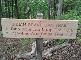
 After 2.2 miles, Crooked Arm comes to an end at the intersection with Scott Mountain and Indian Grave Gap.  I took Indian Grave Gap and continued my climb.  There was a big fat Toad right in the middle of the trail that made me jump when he jumped.  I think I jumped higher.

 Up on Indian Grave, there were a few views off each side of the ridge.  Off one side, you could see towards Towsend, while the other way you could see the cove.


After 2.6 miles on Indian Grave, I turned onto Rich Mountain Loop trail for a 3.4 mile walk down the mountain.  The trail was pretty steep losing about 1600' in only 2.5 miles.  It was a little rocky in a few spots where small streams crossed the trail, but for the most part it was a nice place to spend a Sunday.  I stopped for a few more flower pictures on the way down.


 About 1 miles from the finish, the trail comes out at one of the cabins in the cove.  It was full of tourists.  One kid was running around in only a diaper that looked like it was 2 or 3 days old.  I took a few photos before turning back into the woods and walking the final 1 mile to the car.


 It rained a bit on me on the way up the mountain, but it was a lovely day by the time I got back to the car.
 I was back at the car about 10 till 6:00.  It was a very enjoyable afternoon in the park.

Wednesday, May 13, 2015

Gold Mine - Cooper Rd - Cane Creek - Beard Cane - Ace Gap

Date: 5/13/15
Distance: 17.2

Today I did a key swap hike with the GSHAG meetup group.  We met at Food Lion at 7:00am and traded cars.  I went with JD, Jenn, Steven, and Teresa to the Gold Mine Trail while the rest of the group took a car to Rich Mountain where the Ace Gap trail terminates.  The Gold Mine trail comes very close to the Top of the World Estates.  JD knew where to park and where to hike into the park.  We parked directly across the road from the trail on Steffner Circle.

We started on the access trail for about 0.25 miles before we reached the Gold Mine Trail.  Gold Mine drops elevation quickly for about 0.8 miles before terminating on Cooper Road.  We turned left on Cooper and walked 0.4 easy miles to Cane Creek Trail. On this section of the trail, there was some very nice Mountain Laurel and a few Pink Lady Slippers.


 Cane Creek isn't the most fun to hike.  It is an old road that goes through a bunch of mushy areas and has many creek crossings.  There is a Cemetery on the trail which his probably the only reason this trail exists.
 2.1 miles down the trail, you arrive at a Posted sign, where we turned around and headed back to Cooper Road.
 Back on Cooper, we once again turned left and hiked 1.8 miles out to Beard Cane.  There were a few spots with a few views on this section.

 Beard Cane is a pretty awful trail.  It passes through a valley that was torn up by the tornadoes a few years ago.  Today it was really overgrown with lots of briers and grass.  Jenn saw a snake in the grass that was a bit scary as well.
 Campsite 11 is now closed, but it was invisible due to the growth in the damaged area.
 Beard Cane also had many small creek crossings.  At times the trail and the creek became one as well.


 On this day, we rock hopped them all.  No boot removal was necessary.  The last time I hiked this trail, we had to wade this crossing.
 Beard eventually improved as it climbed up to Ace Gap.  After 4.2 miles, Beard Cane arrived at Ace Gap.   At Ace Gap, we turned right (the only way to stay in the park) and headed for the car.  Ace Gap had lots of Mountain Laurel, a few Flame Azaleas and a number of other wildflowers that JD recognized.


 Ace Gap was 5.6 miles.  The elevation graph looks as if it is rolling, but it felt like we went up more than down.

This set of trails are only trails that a Map Marker can appreciate, but it was still super nice to get out in the woods and go a long way.

Mileage Summary
Access to Goldmine Trail .25
Goldmine .8
Cooper Road .4
Cane Creek 2.1 Out and Back (OAB) = 4.2 miles optional
Cooper Road 1.8
Beard Cane 4.2
Ace Gap 5.6
Total with Cane Creek OAB 17.25


Saturday, May 9, 2015

Rocky Top (Anthony Creek - Bote Mountain - AT)

Date: 5/9/15
Distance: 12.8

Today I went on Angel's Birthday hike with Jeannie, Jenn, Jean, Heather, Margie, Trang, Todd, Rob, Steve and Chuck.  The company was really enjoyable.   The day however was quite warm and humid, so the climb seemed extra tough.

We started on Anthony Creek Trail whose trailhead is in the back of the Cades Cove picnic area.  Anthony starts on a gravel road, but after a mile or so, it becomes more of a single track trail.  It is very rocky in places and pretty steep.

There were a good number of wild flowers on Anthony Creek.


After 3.5 miles, we turned right on Bote Mountain and followed it to the AT.  Bote Mountain was a rocky and steep as ever.  At the AT intersection (1.7 miles), the breeze was blowing a bit allowing me to cool off a bit.  Turning left on the AT, the trip out to Rocky Top is about 1.2 miles.  It was tougher than I remembered.


 Up on Rocky Top, the views were great.


 After lunch and a bit of a rest, we returned via the same route.  I spotted a few more flowers on the way down.
 A small side trail led over to a few rapids.