Distance: 16.6
Today is Black Friday. I chose to #OptOutside instead of shopping (I'm sure that surprises no one), so I drove over to Abrams Campground to hike Rabbit Creek and Hannah Mtn over to Parsons Branch. HOWEVER much to my surprise and delight, I pulled in the parking lot to find Darrell and Russ who were hiking as well. They were hiking Rabbit all of the way to Abrams and hiking Abrams Creek to Hannah back to Rabbit. I started down Rabbit Creek with them and decided to scrap my plans in favor of some fun company.
Rabbit starts with a creek crossing with a Bridge! It then starts climbing up and over a ridge. It felt pretty steep, but it looks to have been only 800'. The trail was very wide (old road), but the trail bed wasn't rocky. It was covered with a nice layer of pine needles for much of the trail.
The 1st 2.7 miles went quickly and we arrived at the Hannah Mtn intersection. At this point, we continued on the Rabbit Creek Trail for another 5.1 miles as it works its way into Cades Cove.
Once you leave the Rabbit/Hatcher intersection, the trail gets a bit more rocky and it spots the trail is a creek. After about 1 mile, you reach the 1st creek crossing. I removed my boots and waded across. It was less than knee deep.
After crossing the creek, the trail gets a bit better. The trail had lost about 500' at the creek and it then climbed 800' after the crossing before losing nearly all of it before it arrived at the Abrams Falls Parking area.
Rabbit finishes with one more creek crossing. I once again removed the boots and waded across. The creek was less than knee deep.
There were all kinds of people at the trailhead. Darrell found a few folks to espouse the awesomeness of hiking to.
Channel 10 was also there and they interviewed Darrell and filmed us walking by. We made the cut onto the 5:30 newscast.

After the interview, we took off down the Abrams Falls trail. There were a large number of people on the trail. We must have passed about 100 hikers. There was one very large group of folks on a ranger led hike that accounted for about 1/2 of them.
2.6 miles down this trail, we arrived at the falls. It was beautiful but it was packed with people.
We sat down for some lunch and Darrell found some Sushi.
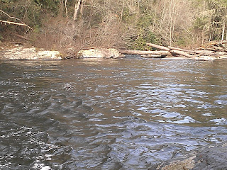
After a short lunch, we continued on down the Abrams Falls Trail to finish the 4.2 miles. The trail ends at a very wide very deep creek crossing. the water was thigh deep on me as I made it across. Darrell and Russ chose different routes with different results.
Back at Rabbit Creek, we turned right to return to the car. The climb up Rabbit felt surprisingly steep even though we didn't climb an extreme amount today.
There were a few views through the trees.
I failed to start the GPS for the 1st bit of the hike, so you'll have to look at the end of the graph below and mentally add it to the beginning. The elevation change wasn't extreme today, but the climbs on Rabbit felt very steep.


No comments:
Post a Comment