Distance: 19.6 miles
With the closing of the Clingmans Dome Road looming in just 9 more days, I thought I should mark off a few trails which leave from Clingmans Dome. Today was a monster loop hike covering 19.6 miles while losing and gaining nearly 5000' in the process.
I got started about 8:15 heading up the paved Clingmans Dome trail to get the heart pumping. The early morning views from the Dome were great.
At the tower, I turned left on the AT. The views were really nice along the trail. I just love this section of the AT. It has views off of both sides of the trail and they are spectacular when the weather is good.
Jonas continued the down hill stretch for another 4.2 miles.
About 1 mile down Jonas Creek, the creek 1st made its appearance. There were a total of 5 creek crossings. I had to wade most of them. I carried my Chacos today and wore them for about 2 miles on Jonas.
This tree was nicely positioned to avoid wading on the 1st crossing.
I wasn't so lucky on the 2nd, so the Chacos went on here.
There is a campsite right at the end of Jonas where I had lunch and put my boots back on as I knew there was a log bridge to get to Forney Creek. This was the lowest elevation of the hike.at 2400'. I knew I had my work cut out for me as the Car was at 6300'.
Forney Creek is wide and easy hiking even though it steadily climbed up the mountain for the 1st 5 miles or so. It follows the path of an old rail track which was used for logging, but alas there were no bridges, so the Chacos went back on for about 4 creek crossings on Forney. There were another 3 or 4 crossings that I was able to hop. It had rained about 2" on Wednesday night, so the water was higher than usual.
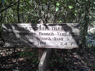
It felt like forever to cover the 7.4 miles on Forney Creek. It ends at Forney Ridge where I turned left for the final 1.1 miles back to the car. This section of the trail gained another 500'.
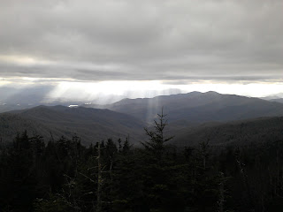
Back at the Dome, the clouds had moved in, with a few sunbeams sneaking through.


No comments:
Post a Comment