Saturday, November 28, 2015

Low Gap - AT - Snake Den Ridge - Cosby Campground Trails

Date: 11/28/15
Distance: 15.8 miles

One benefit of running into Russ yesterday was that we were able to plan a hike for today as well.  Today we went to the opposite end of the park to hike in Cosby.  We began our hike on Low Gap which is tough.  It climbs about 2000' in 2.9 miles (from the Hiker Parking area).  We covered it in good time arriving at the gap after about 1 hour of hiking.

After a short rest, we turned to the right and began our hike on the AT.

 The AT climbs another 500' or so before it peaks.  At the top the trail is right on the ridge which gives some nice views off of each side.


 The trail then loses about 400' before it arrives at Camel Gap after 2.4 miles on the AT.  From that point the AT climbs about 1000' over 2.3 miles to the Snake Den ridge Trail.  This climb was tough after the big climb earlier in the hike.

We stopped for lunch at the Snake Den Ridge intersection.  After a 15 minute rest, we started the big down hill drop on Snake Den Ridge.  The top of this trail is very rocky which slowed progress, but it does improve as you get lower.  There are a few views off of the side of this trail as well.
There was also a small waterfall.


 There was also a very long footbridge near the bottom.


 After 5.3 miles and a drop of about 3500', we arrived at the Cosby Campground.

 One of the silly things that Map Markers do is hike all of the Cosby Campground trails.  At this point in the hike, we had only covered about 13 miles and we had some time, so we backtracked up Snake Den 0.2 miles to the connector to Low Gap and hiked it along with all of the other arcs and stubs around the campground.  We continued this over to the Horse Trail which we hiked down to the road and then back up the road to do the same on the connector between Gabes and Snake Den.

In all we figure we hiked 15.8 miles.  It was another really nice day in the park.

Rabbit Creek - Abrams Falls - Hannah Mtn

Date: 11/27/15
Distance: 16.6

Today is Black Friday.  I chose to #OptOutside instead of shopping (I'm sure that surprises no one), so I drove over to Abrams Campground to hike Rabbit Creek and Hannah Mtn over to Parsons Branch.  HOWEVER much to my surprise and delight, I pulled in the parking lot to find Darrell and Russ who were hiking as well.  They were hiking Rabbit all of the way to Abrams and hiking Abrams Creek to Hannah back to Rabbit.  I started down Rabbit Creek with them and decided to scrap my plans in favor of some fun company.

Rabbit starts with a creek crossing with a Bridge!  It then starts climbing up and over a ridge.  It felt pretty steep, but it looks to have been only 800'.  The trail was very wide (old road), but the trail bed wasn't rocky.  It was covered with a nice layer of pine needles for much of the trail.

The 1st 2.7 miles went quickly and we arrived at the Hannah Mtn intersection.  At this point, we continued on the Rabbit Creek Trail for another 5.1 miles as it works its way into Cades Cove.

Once you leave the Rabbit/Hatcher intersection, the trail gets a bit more rocky and it spots the trail is a creek.  After about 1 mile, you reach the 1st creek crossing.  I removed my boots and waded across. It was less than knee deep.


 After crossing the creek, the trail gets a bit better.  The trail had lost about 500' at the creek and it then climbed 800' after the crossing before losing nearly all of it before it arrived at the Abrams Falls Parking area.

Rabbit finishes with one more creek crossing.  I once again removed the boots and waded across. The creek was less than knee deep.

 There were all kinds of people at the trailhead.  Darrell found a few folks to espouse the awesomeness of hiking to.

Channel 10 was also there and they interviewed Darrell and filmed us walking by.  We made the cut onto the 5:30 newscast.
 

After the interview, we took off down the Abrams Falls trail.  There were a large number of people on the trail.  We must have passed about 100 hikers.  There was one very large group of folks on a ranger led hike that accounted for about 1/2 of them.


 2.6 miles down this trail, we arrived at the falls.  It was beautiful but it was packed with people.


 We sat down for some lunch and Darrell found some Sushi.
 After a short lunch, we continued on down the Abrams Falls Trail to finish the 4.2 miles.  The trail ends at a very wide very deep creek crossing.  the water was thigh deep on me as I made it across.  Darrell and Russ chose different routes with different results.


 After the crossing, the Hannah Mountain trail covers the 1.9 miles back to the Rabbit Creek Trail.  It climbs about 500', but didn't feel too steep.  Both Hannah and Rabbit had areas that were damaged by tornadoes a few years ago.

 Back at Rabbit Creek, we turned right to return to the car.  The climb up Rabbit felt surprisingly steep even though we didn't climb an extreme amount today.

There were a few views through the trees.


 I failed to start the GPS for the 1st bit of the hike, so you'll have to look at the end of the graph below and mentally add it to the beginning.  The elevation change wasn't extreme today, but the climbs on Rabbit felt very steep.

Saturday, November 21, 2015

AT - Welch Ridge - Jonas Creek - Forney Creek - Forney Ridge

Date: 11/21/15
Distance: 19.6 miles

With the closing of the Clingmans Dome Road looming in just 9 more days, I thought I should mark off a few trails which leave from Clingmans Dome.  Today was a monster loop hike covering 19.6 miles while losing and gaining nearly 5000' in the process.

I got started about 8:15 heading up the paved Clingmans Dome trail to get the heart pumping.  The early morning views from the Dome were great.


 At the tower, I turned left on the AT.  The views  were really nice along the trail.  I just love this section of the AT.  It has views off of both sides of the trail and they are spectacular when the weather is good.


 After 4.1 miles on the AT, I turned left on Welch Ridge and the downhill portion of the hike began.  Welch was in really nice shape.  It was easy downhill hiking for 2.5 miles to Jonas Creek.
 Jonas continued the down hill stretch for another 4.2 miles.
 About 1 mile down Jonas Creek, the creek 1st made its appearance.  There were a total of 5 creek crossings.  I had to wade most of them.  I carried my Chacos today and wore them for about 2 miles on Jonas.
 This tree was nicely positioned to avoid wading on the 1st crossing.
 I wasn't so lucky on the 2nd, so the Chacos went on here.
 There is a campsite right at the end of Jonas where I had lunch and put my boots back on as I knew there was a log bridge to get to Forney Creek.  This was the lowest elevation of the hike.at 2400'.  I knew I had my work cut out for me as the Car was at 6300'.
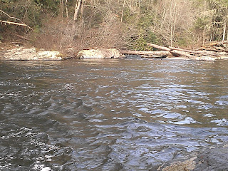
 Forney Creek is wide and easy hiking even though it steadily climbed up the mountain for the 1st 5 miles or so.  It follows the path of an old rail track which was used for logging, but alas there were no bridges, so the Chacos went back on for about 4 creek crossings on Forney.  There were another 3 or 4 crossings that I was able to hop.   It had rained about 2" on Wednesday night, so the water was higher than usual.


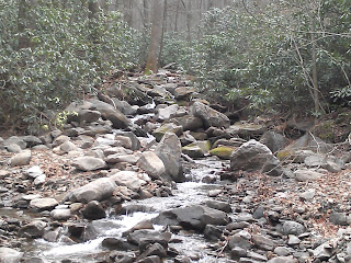
 The last 2.5 miles are very steep.  On this section, it is much more rocky and mushy as well.  The climb is also brutal with a climb of 1800'.  There was a nice water slide and a cascade along this section.


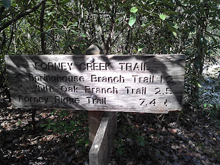
 It felt like forever to cover the 7.4 miles on Forney Creek.  It ends at Forney Ridge where I turned left for the final 1.1 miles back to the car.  This section of the trail gained another 500'.

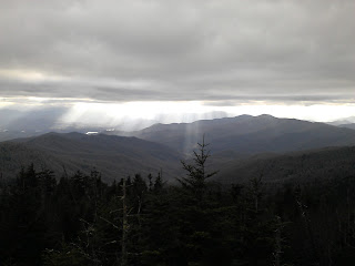
 Back at the Dome, the clouds had moved in, with a few sunbeams sneaking through.


 This was a long tough hike, but it was rewarding to mark it off of map #2.