Distance: 15.7
New Map Miles: 3.8
Total Map Miles: 800.8 DONE!
I crawled out of the tent about 7:00am not having had much sleep, but anxious to get going on the 2nd day of my map finishing backpack. I loaded up on oatmeal and we broke camp hitting the trail about 8:15. The day was pretty cold. I'm estimating it was less than 40. We knew there was a creek crossing 1st thing on Cold Springs, so we headed down the trail with some worry and dread as we expected the water to be high and fast and cold. The crossing met our expectations.

I had heard lots of bad things about Cold Springs, so I was expecting the worse. It has lots of water crossings, but all except the 1st we rock hopped. It also had lots of rocks and many mucky spots. At times the trail and the creek become one and it is a big climb (~2500ft).

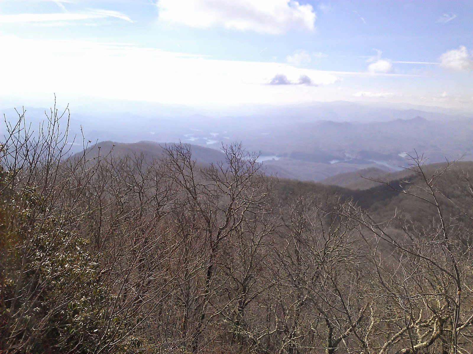
I hadn't planned to finish my map with such a challenge, but in the end it felt right. The challenging hikes are the most rewarding and in some ways my favorites. That said, I was pretty happy when we reached to top of Cold Springs and were greeted with some views through the trees.

At this point the trail turns to the left and the name changes to Welch Ridge. This was still new trail for the next 0.5 miles up to the High Rock Trail. It was relatively steep steady climb up to the High Rock Trail, but I was pumped up knowing it was the end of the journey. At the High Rock Sign, my Map was DONE.


I ditched the pack and jogged out to High Rocks for a few glorious views of the valley below.


Russ needed the bottom 1.1 miles of Forney Creek, so we turned left at that trail and then turned right at Whiteoak. At the time the climb up Forney and Whiteoak seemed horrible. It is a little funny to see the tiny bump on the elevation plot below.
At Lakeshore, we took a left and exited through the Tunnel to Nowhere. Russ's Mom and Wife were super nice to come pick us up and shuttle us back to Clingmans Dome where my car was waiting.
.jpg)
No comments:
Post a Comment